One of the challenges that we have working with Civil 3D is that we have a lot of different formats to handle. This could be both to export to and import from. In this blogpost I will focus on the SHP-format and were Naviate will come in to help you handle the format.
What is SHP?
ESRI SHP-file is a GIS-file format that can contain both geometry and data connected to the geometry. The format can only handle AutoCAD-geometry though, and the data is handled as attributes.
How do I import SHP-file?
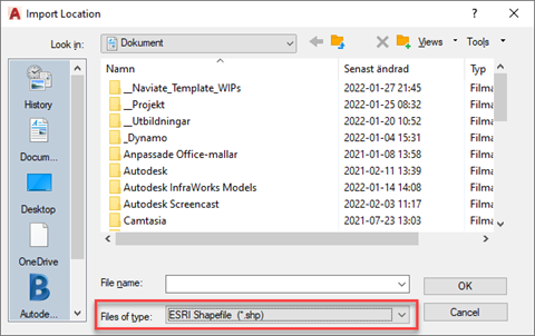
SHP-files can be imported with MAPIMPORT by selecting ESRI Shapefile as type.
When importing the SHP-file make sure you import the data as well, it is usually not imported automatically.
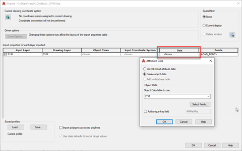
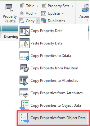
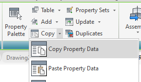
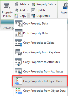
The data is imported as Object Data that is stored on each object and can be viewed on the AutoCAD Properties palette. Object data can be copied over to a Property Set with the Naviate command Copy Properties from Object Data. This command will create a Property Set, apply that to all objects selected and then copy the Properties from the objects Object Data over to the Property Set.
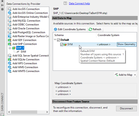
You can also connect to a SHP-file through the AutoCAD MAP-command MAPCONNECT. Note that this method doesn’t save the information from the SHP-file to the drawing, this handles the SHP-file as a database and displays the information for reference purposes.
How do I export to a SHP-file?
Since the SHP-file only handles AutoCAD-geometry with attributes, before exporting to a SHP-file, your Civil 3D design needs to be exported to AutoCAD geometry
To do this there are multiple commands that can be used, depending on what type of design you have. This blogpost will not go through all options that are available, remember that the SHP-format can only handle Point, Line, Polygon and Text – so those are the object types you are aiming for. Note that Line includes 3Dpolylines and Polygon is used for closed polylines.
For most Civil 3D objects that means you want to export to 3Dpolylines. Naviates Export Corridor does this for Corridors, andMultiple 3D Polys from Network can handle this for Pipe Networks.
Once the geometric objects are created, the property set needs to be either applied or copied over from their Civil 3D counterpart. Some Naviate-commands copies Property Data when exporting, if the data needs to be copied manually, Copy Property Data can be used.
Once the data is on the geometric objects as a Property Set, then the command Copy Properties to Object Data copies the information from the Property set to an Object Data-set on the objects.
There is a limitation in Object Data regarding length of names so if you have long Property Names you will see that the names in the Object Data set is truncated.
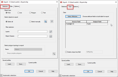
When your file is ready, then MAPEXPORT is used to export to a SHP-file. Make sure you include to export the Data from attributes.